Monday, March 29, 2010

Heading North along Sudanese Coast ~ Wreck Recovery Anchorage

Current Position: North 21*01'071 East 037*18'410

We left Port Suakin three days ago after enjoying a great stop in a really interesting Sudanese town, literally like stepping back in time with donkey carts and goats everywhere!! A group of us took the hour long bus trip into Port Sudan for a look around a bigger city and to restock on fresh meat and vegetables. The Sudanese people are extremely friendly and we got nothing but warm smiles and words of welcome everywhere we went. The only down side is that it's an expensive country to check into for a short period of time at US$130 but well worth the cultural experience.

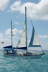
Now we're back underway and slowly making some distance north, we have to wait for low winds and move in the mornings or over night as the afternoon seems to be the most windy. We're currently anchored behind a reef in 'Wreck Recovery anchorage' and plan to head out tomorrow morning and see how far we can get. The coast line here consists of pretty much desert with high mountains in the distance, occasionally we've seen a tent or small village but otherwise there seems to be very little sign of life but very spectacular!

----------
radio email processed by SailMail
for information see: http://www.sailmail.com

Monday, March 22, 2010

Shab Teeta ~ Shubuk Channel

Current Position: North 18*45'906 East 037*36'877

Yesterday we made the hop 55 miles north and are now anchored behind Shab Teeta island at the eastern end of the Shubuk Channel. The Shubuk Channel is a pass through a reef system along the coast that will allow us to motor through with flat calm seas. Today we plan to head 30 miles north to Port Suakin but at the moment we have to wait for better visibility as it's poring down with rain...very unexpected!!

----------
radio email processed by SailMail
for information see: http://www.sailmail.com

Sunday, March 21, 2010

Khor Nawarat ~ Sudan

Current Position: North 18*15'067 East 038*19'722

After an over night sail from Massawa in Eritrea we stopped to anchor behind a small group of island called Khor Nawarat and have been here ever since! The northerly winds filled in at 25-30 knots making it impossible for us to make the next jump 50 miles north of here to Long island. We are now in Sudan and roughly a third of the way up the Red Sea, the islands here are very dry and flat but we've been able to catch fish from the dinghy and pick clams from the sand at the waters edge. We are here with six other yachts and have been meeting ashore every evening to light a bonfire and cook whatever we've caught during the day.

It looks like tomorrow the wind will lessen enough for us to make a push north and we're hoping to be in Port Suakin in a couple of days. From Suakin we'll catch a bus to Port Sudan to restock our food supplies and take a look around the old city.

----------
radio email processed by SailMail
for information see: http://www.sailmail.com

Tuesday, March 16, 2010

Massawa, Eritrea.

Current Position: North 15*36'676 East 39*28'292

We've been anchored here in the Port of Massawa for five days and have just gotten back from an inland trip to Eritrea's capital 'Asmara'. It cost us one US dollar to ride the four hour bus trip up through Eritrea's mountain range rising up from the African desert. For around forty five years Eritrea was colonised by the Italians ending in 1941 but the culture and architecture is still very prominent making Asmara a beautiful old city. On sunday we rode the refurbished Eritrean Steam railway from Asmara to the village of Nefasit winding through spectacular scenery and a real treat that we least expected!

Our plan now is to sail north tonight to try and make the 180 miles to Khor Nawarat before the next set of Northerly winds set in.

----------
radio email processed by SailMail
for information see: http://www.sailmail.com

Monday, March 8, 2010

Mersa Dudo

Current Position: North 13*51'925 East 041*54'525

We sailed another 24 miles up the coast of Eritrea today and are now anchored off Mersa Dudo on the mainland. The headland looks like a Mars Scape with red sandy hills and a dormant volcano. A group of fishermen live in a few huts made of rocks at one end of the beach and they've already visited us on their skiff asking for cigarettes, food and water. We gave them a small pack of biscuits and a couple of Oranges of which they seemed to be more excited about the latter, I guess fresh fruit is hard to come by out here!

The wind is howling down through the anchorage and blowing over 30 knots at times which is considerably more than off shore. It was a bit unexpected so we've opted against climbing the volcano as planned and have been stuck on the boat most of the afternoon. Tomorrow we plan to make an overnight trip towards the town of Massawa and decide along the way where to stop the following night. We're in company with five other yachts at the moment but it looks like we may be parting company with a couple of them tomorrow.

----------
radio email processed by SailMail
for information see: http://www.sailmail.com

Sunday, March 7, 2010

Dannabah island ~ Heading North

Current Position: North 13*40'012 East 042*10'476

Today we sailed 55 miles north from our last anchorage with South Easterly winds reaching over 30 knots. Our first choice of an anchorage at a headland called Ras Terma had to be abandoned as the hills acted as a wind funnel and we were hit by a sand storm with winds reaching 45 knots. Our current location is off a low lying island and is a lot more comfortable although we still have plenty wind but much calmer seas. We caught our first Red Sea fish today a medium sized Yellow fin Tuna but have also already lost three of our lures to much larger fish...very frustrating!

----------
radio email processed by SailMail
for information see: http://www.sailmail.com

Saturday, March 6, 2010

Through the Bab El Mandeb and In the Red Sea!

Current Position at anchor: North 12*58'205 East 42*50'381

We're currently anchored off a small Eritrean island in the Lahaleb Desert just forty miles inside the Red Sea. Passing through the straights yesterday we had to motor sail across the shipping channel and are now on the African coast. The winds have picked up from the south so we plan to leave here tomorrow and then decide how far we will go depending on the conditions.

----------
radio email processed by SailMail
for information see: http://www.sailmail.com

Wednesday, March 3, 2010

Ras Al Arah, Yemen ~ Aden to the Bab el Mandeb straights.

Current Position: North 12*37'818 East 43*54'699

Yesterday afternoon we left the Port of Aden after a really enjoyable stay and are now anchored off the village of Ras Al Arah seventy miles to the south. This will be our last stop before passing through the Bab el Mandeb straights and into the southern part of the Red Sea. The Yemeni coast line is pretty spectacular with sandy mountains fringing the water and small fishing villages scattered in what seems the middle of nowhere! We've been approached by a lot of fishermen in skiffs and they all seem extremely friendly and are willing to trade fish for food, cans of coke or cigarettes.

We plan to wait here until Saturday when we should have more favourable southerly winds to help us through the straights and then on to the town of Massawa in Eritrea about 300 miles north on the African coast. We're traveling in company with three other yachts which is a much more comfortable group compared to the twenty seven we arrived in Aden with!

----------
radio email processed by SailMail
for information see: http://www.sailmail.com