Tuesday, February 17, 2009

Krabi - Thailands Climbing Mecca!

Current Position: North 08*00'711 East 098*49'844 - Rai Lei Beach, Krabi Province.

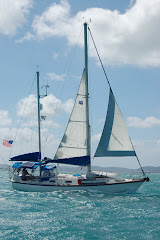
We've landed in a Climbers dream with beautiful white sandy beaches framed by spectacular limestone pillars covered in caves and fissures. The water is still pretty clear and the beautiful emerald green colour that we've seen everywhere here in Thailand, with so many little bays and crevices it's a perfect place for Kayaking and exploring in the dinghy. We've been checking out the beaches with lots of great little restaurants tucked back in to the rain forest and a great place to watch climbers scaling every available cliff face. They give half, full and three day courses on Climbing so we're seriously considering giving it a try as we're going to be around for a while and it looks like a great way to keep fit!
We've been trying all kinds of new Thai Dishes and love them all, it really seems like you can't go wrong if you like vegetables and spicy food! Prices range from 35 Baht (1 US Dollar) to around 150 Baht depending on the restaurant but they all have ridiculously long menu's so 'plenty' of choices... not so good for those of us who can be a little indecisive though!
Today we'll be moving further north into 'Phang Nga Bay' to check out some more islands on our way to Phuket. This area is also known as the Hong group with many bays almost completely enclosed by high cliffs and deep caves...sounds like a lot more exploring to be done.

----------
radio email processed by SailMail
for information see: http://www.sailmail.com

Sunday, February 15, 2009

Koh Phi Phi Don.

Current Position: North 07*43'798 East 098*46'260 - Ton Sai Bay, Phi Phi Don.

The Last couple of days we've spent in the busy anchorage off the island of Koh Phi Phi Don. A small island with two big horse shoe bays facing North and south with long white sandy beaches and beautiful towering cliff faces. It's a really popular spot for tourists and back Packers so lots going on ashore with little lanes packed full with souvenir sellers and bars and Restaurants. The water is the clearest we've seen so far so good for snorkeling and swimming from the boat or beach and there's a beautiful lookout spot on the top of one of the hills if you can survive the steep climb in the 40*C temp's. This island was severely hit in the tsunami but you could never tell now, they've recovered really well and new buildings are sprouting up just about everywhere.

On our way here we stopped off at the island of 'Koh Phi Le' just 3 miles south to take a look at Maya Bay which is where they filmed the movie 'The Beach'. It's a really popular place for tourists and dive boats so a bit too crowded for us to anchor in the bay but we may take a long tail boat over from here to get a better look. We plan to head to the mainland next to an area called 'Krabi' which is supposed to be great for hiking, Kayaking and rock climbing so I guess we're going to have to get Physical!!

----------
radio email processed by SailMail
for information see: http://www.sailmail.com

Thursday, February 12, 2009

The Emerald Cave.

Current Position: North 07*24'828 East 099*12'764 - Anchored off 'Koh Ngai' Island.

After leaving Koh Tarutao two days ago we stopped on the western side of Koh Muk off a small beach with a couple of resorts ashore. The wind decided to blow from the North West making it a really rolly night at anchor, well worth it though as yesterday morning at 7 am we dropped the dinghy and motored around to the North side of the island to visit the 'Emerald Cave'! From the outside it looks like a normal cave and we took the dinghy through the 80 Metre completely dark passage way, for which we'd come prepared with head lamps, and finally opened up into an enclosed circular 'Hong' with a beach surrounded by high cliffs and open to the sky. The sides are coated in lush vegetation and the only way in is by the cave or rock climbing! Really beautiful and we were there early enough to be the first ones that day and had it completely to ourselves giving it the feel of a natural cathederal. Apparently Pirates used to hide their treasures in the hong before moving them on to other stores...pretty amazing as you'd never expect it to be here from the outside.

Back at the boat though the rolling had become unbearable so we picked up anchor and sailed 6 miles to this island called 'Koh Ngai' and anchored on the east side off a long white sandy beach. We spent the day catching up on sleep and then headed ashore to check out the four resorts that line the beach. Surprising enough we had landed ourselves in German territory as everything was written in German, owned by Germans and all the tourist were German! very strange but we did manage to have our first taste of Thai Green Curry for just 140 Baht which equals about 4 US dollars. We made a slight mistake with the Tides though and had to wait for three hours before the water came back in far enough to cover the reef so we could get the dingy back to Blue Moon. Today we are moving on but not sure where to, there are so many islands that we'll just pick somewhere along the way that takes our fancy!!

----------
radio email processed by SailMail
for information see: http://www.sailmail.com

Tuesday, February 10, 2009

First anchorage in Thailand - Ko Tarutao.

Current Position: North 06*38'192 East 099*36'903

We've just left our first anchorage in Thai waters off the island of 'Ko Tarutao', the furthest south of Thailand's Islands and just 15 miles north of Langkawi. A beautiful spot with a long white sandy beaches in the national park and a great place for nature lovers with monkeys and huge eagles everywhere, there were even Buddhist monks camping on the beach...welcome to Thailand!

Checking out of Malaysia yesterday was an extremely smooth and free process and we now have 10 days before we need to officially check in to Thailand in Phuket. Today we're heading 50 miles further north to the island of 'Ko Muk' where we've been told the water is crystal clear so we can finally get back in to doing some snorkeling and check out the 'Emerald Cave'. We have very little wind so we're motor sailing while trying to avoid the hundreds of flags that mark the floats of long fishing nets, a difficult task as they're everywhere!

----------
radio email processed by SailMail
for information see: http://www.sailmail.com

Saturday, February 7, 2009

Telaga Harbour, Langkawi.

Current position: North 06*21'781 East 099*40'899

We left Georgetown city marina yesterday morning and had a great trip back up north to The Langkawi Islands, stopping last night in one of the beautiful southern anchorages on Pulau Singa Besar. Today we sailed around to the North west coast of the main island to Telaga Harbour, anchored in 8 feet of water in a well protected bay just out side the marina. There are about 30 other boats anchored here but plenty of space and well protected from the south by two long islands, the view from the boat is beautiful with high mountains overlooking the bay and a long white sandy beach surrounding the waters edge. The marina itself is pretty isolated but we plan to hire a car tomorrow and drive into the town to stock up on duty free goods before checking out with immigration and heading on to Thailand in a couple of days.

----------
radio email processed by SailMail
for information see: http://www.sailmail.com