Sunday, May 24, 2009

The Hole in the wall, Langkawi.

Current Position: North 06*25'171 East 99*51'993 - Kilim River, Langkawi Geopark.

We've moved around to the East coast of Langkawi's main island and are now anchored in the Kilim River, known locally as the 'Hole in the Wall', in Langkawi's Geopark. It's quite literally a hole in the wall as the entrance to the river is flanked by two towering cliff faces just twenty meters wide. Inside there's a labyrinth of mangrove rivers and creeks that we've spent hours exploring alongside huge limestone pinnacles filled with crevices and caves and home to hordes of Bats!

The Geopark is also home to hundreds of Eagles and from the boat we've able to watch them dive down and feed on fish from the murky river. The numerous tour boats stop to throw pieces of chicken out that they grind up in their engine propellers and create a feeding frenzy often with over twenty eagles swooping down to join the feast...quite an impressive sight.

Today took the dingy up the river to the main boat dock and from there walked up to the 'Galeria Perdana', a gallery showcasing over 2,500 Gifts that Malaysia's longest serving Prime Minister received while in office. Apparently it's the only one in the world and I have to admit it's pretty interesting to see what kind of things other countries give...everything from a tiny ceramic cup from Jordan to ornate Chinese vases and a carriage coach from Pakistan. Jimmy on the other hand found the air conditioning to be the most impressive thing and with temperatures outside now up in the high 30*C/90*F range it was a god send to have a break for a couple of hours!!

----------
radio email processed by SailMail
for information see: http://www.sailmail.com

Monday, May 18, 2009

Back in Langkawi!

Current Position: North 06*21'721 East 099*40'716 - Anchored off Telaga Marina.

We made it back to Langkawi a couple of days ago and are comfortably anchored off Telaga Marina on the main island. Checking in went very smoothly except for immigration taking a very long and detailed look at our passports to see if we'd been in Mexico recently...I guess Swine flu is effecting everyone. No complaints though as Malaysia don't charge anything to check in or out.

There's not a lot here in Telaga except for the marina but it's a great place to rent a cheap car and run around into town and the surrounding shops to restock on lots of cheap goodies! We're back in the land of plenty (booze and chocolate) all duty free so we're going to make the most of it!! Our plan now is to start work on Blue Moon cleaning and re-varnishing before I fly home for a visit and Jimmy's mum flies out in about four weeks time.

----------
radio email processed by SailMail
for information see: http://www.sailmail.com

Saturday, May 9, 2009

The Butang Group.

Current Position anchored off Koh Lipe Island: North 06*29'083 East 099*18'083

We've slowly been making our way south and are now anchored in the Butang Island Group just a few miles north of Langkawi and the Malaysian border. Along the way we stopped at the islands of Koh Lanta, Koh Kraden and Koh Bulon Le all of which are extremely beautiful with some great snorkeling and even better beaches.

Today we had our first taste of the South West monsoon weather after being hit by a storm with over 30 knot winds, torrential rain and rough seas, all coming from the way we were headed. Apparently we've become lazy with preparing the boat before a passage as just about everything that wasn't tied down decided to fly around becoming lethal weapons and creating a huge mess. We slowly beat our way up into the island group and finally found a free mooring in nice looking bay with lots of touristy restaurants ashore. It's a little rolly but now that we've managed to dry ourselves off and eaten a warm meal we should sleep just fine!

----------
radio email processed by SailMail
for information see: http://www.sailmail.com
Friday, April 24, 2009

Heading back South.

Current Position at Koh Phi Phi Don Island: North 07*43'514 East 098*46'239

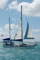
After a hectic few weeks of exploring Phuket island in more detail on our 'Pink' rented moped and a sail up to James Bond island in Phang Nga Bay we finally checked out of Thailand in Ao Chalong bay on Monday (also Jimmy's Birthday) and are heading back south to Langkawi in Malaysia. We've been in Thailand for over two months now and instead of spending over $100 to renew our visa for another month we decided to slowly make our way back south stopping at our favorite islands on the way and some that we missed on our trip up.

Jimmy was very unhappy with the fact that it appears the whole Thai fishing fleet is here in Ton Sai Bay sheltering from the rough seas and have taken up all the best anchor spots. We had no choice but to drop ours out the back of the bay in 70ft of water as getting close to 14 huge wooden boats rafted together, a record so far, wasn't a good option ... (an electric anchor winch becomes more appealing every day!!)

April marks the change of the seasons here and we're starting to get some squally weather and a lot more wind and swell from the West. The temperature has continued to increase which has been unbearable at times, especially when trying to sleep at night with just a tiny fan moving the warm air around - making breathing a little easier. With highs around 40*C we break out in a heavy sweat doing the simplest of things and have to lather up in sunscreen before heading ashore so as not to get completely fried. It's not all bad though and on our trip from Phuket to here we were able to sail down wind the whole way which is a first for us here in Thailand and great to save on some fuel...finally the wind seems to be in our favour!

We plan to spend a couple more days here enjoying our last really touristy anchorage with all the back packer bars and restaurants and what could be the last of the clear water that we'll see until we're back up this way in October.

----------
radio email processed by SailMail
for information see: http://www.sailmail.com
Saturday, March 28, 2009

The Similan Islands

Current Position: North 08*34'114 East 097*38'576 - Moored off Ko Miang Island.

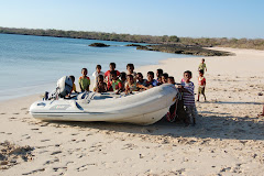
The Similan Islands named after the Malaysian word 'Sembilan', meaning 'nine', are a group of nine islands roughly 35 miles west of the coast of Thailand and 50 miles south of the Surin Islands. Much like the Surins the Similans are run by the national park and beautiful green islands fringed by pristine coral reef. The water clarity is even better than that of the Surin's and are home to an abundance of tropical fish. With the diving supposedly the best in Thailand dive charter boats arrive in flocks and present a never ending stream of activity.

We've been tied to a mooring here for almost a week and have been able to find something new to do everyday from Hiking the trails ashore to discovering new little bays to snorkel and an array of fish we've never seen before! We're sad to leave but today we are heading back to civilisation and the hustle and bustle of Patong Bay on Phuket island. We finally ran out of fresh food and have been eating through our stores of tins for a while now, with both of us craving a nice big salad and fresh meat we've decided it's time to head back and reconnect with the outside world with definite plans to come back again soon!

----------
radio email processed by SailMail
for information see: http://www.sailmail.com

Friday, March 20, 2009

The Surin Islands - Another Paradise found.

Current Position: North 09*24'876 East 097*52'449

We've been here in the Surin Islands for over a week now and are loving their beauty both above and below the water. The Surin's consist of two main Islands managed by Thailand's national Park, roughly 35 miles off the west coast of Thailand and 5 miles south of the Myanmar (Burma) boarder. Thanks to the National Park the islands are pretty much untouched except for two ranger stations and camp grounds for tourists and a local 'Sea Gypsy' village which is home to the 'Mokan' tribe.
There are loads of Mooring balls provided for both us cruisers and the many dive boats that frequent the islands which helps to protect the pristine reef from badly placed anchors. The water is crystal clear and the beaches pearly white fringed by dense green rain forest stretching up to the tips of the islands high peaks. We've probably seen more species of coral fish here in one place than anywhere else we've been and all this can be seen by jumping off the back of the boat with snorkel and fins!!
The ranger stations have a small restaurant for the workers and campers which has allowed us to stretch out our diminishing food supply as we are almost out of fresh and making the most of our stored up cans. We're low on petrol for the dingy engine so we've been kayaking everywhere which has actually been a lot of fun and allowed us to sneak up on monkeys and huge lizards on the beach...the exercise is pretty good too! The Park fee for seven days for us and the boat is 500 Thai Baht which equals about $15 US or 10 British pounds and well worth every penny. Tomorrow we'll be heading 50 miles south to the Similan islands, also a part of the national park, consisting of nine islands and supposedly even more abundant in marine life!

----------
radio email processed by SailMail
for information see: http://www.sailmail.com

Wednesday, March 11, 2009

Almost in Burma!

Current Position: North 09*43'654 East 098*23'061 - Anchored off Ao Yai Beach on Ko Phayam island - 10 miles south of the Burmese Boarder.

In the past ten days we've slowly made our way up the west coast of Thailand stopping at some fantastic bays and only once seeing other cruisers. The scenery is beautiful with miles of white sandy beaches fringed by thick green jungle and inhabited by local sea Gypsy villages. The weather has been pretty good although it's supposed to be the North East season and the wind continues to blow from the North West making some of the anchorages a little rolly and the odd afternoon thunderstorm bringing a deluge of rain. Temperatures have been up around 35*C/95*F everyday making a walk on the beach feel like your walking in an oven...even the water temperature is so warm that going for a swim doesn't really help to cool off!
For the past two days we've been anchored off a beautiful island called Ko Phayam and a little piece of heaven just 10 miles south of the Burmese boarder, There's a 3km-long sandy beach scattered with a number of eclectic beach bungalows each with their own bar and restaurant. It has a much more laid back atmosphere here compared to the hustle and bustle of some of the more touristy islands further south but still has enough going on to keep us entertained! Yesterday we hiked the concrete moped 'highway' that crosses the island through cashew nut plantations to have lunch at the 'main' village, named this as it has the only dock that services the island, a beautiful walk shaded by the lush vegetation with some great little restaurants along the way to stop and cool off.
With the full moon the tides here are huge at the moment and yesterday we made the mistake of leaving the dingy at the top of the beach at high so when we returned we had to drag her 300 feet along the beach in the heat of the day - it took us over half an hour and we could barely breath by the time we finally got to the water. We won't be doing that again so today we'll blow up the inflatable kayaks which will be much easier to carry then rent a moped to explore some more and keeping a little cooler!!

----------
radio email processed by SailMail
for information see: http://www.sailmail.com